The HELIUX Focus transforms aerial surveying with intelligent automation and unmatched precision. This advanced AI-powered gimbaled system delivers professional-grade data collection for industries that demand accuracy and efficiency.

Smart Target Acquisition | Advanced AI automatically identifies and tracks fixed objects, calculates precise coordinates, and adjusts the gimbal in real-time—delivering sharp, accurate imagery even during dynamic flight conditions.
Quality Assurance Built-In | Integrated AI filters eliminate suboptimal data, selecting only the sharpest images with optimal overlap and spatial accuracy. No more sorting through thousands of unusable shots.
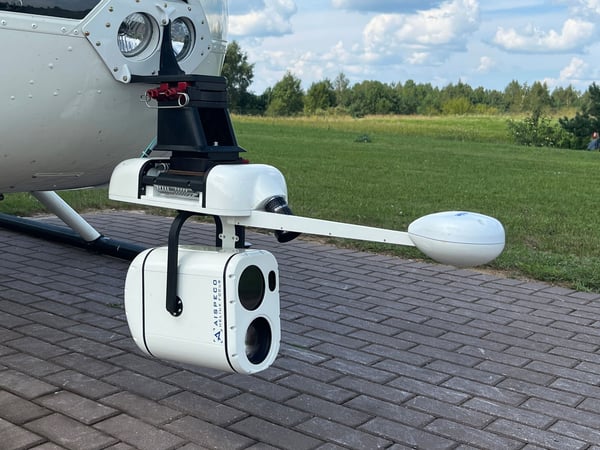
Precision Gimbal Control | Professional-grade stabilization ensures optimal camera orientation throughout your mission, regardless of aircraft movement or environmental conditions.
Multi-Sensor Ready | Compatible with RGB and thermal sensors, plus Sony powerzoom lenses for enhanced imaging capabilities across diverse applications.
Flexible Survey Patterns | Choose from multiple survey modes including Whisk Broom for large-area coverage, Circular Oblique for detailed multi-angle capture, POI Follow for continuous high-resolution tracking, and Follow The Line for precise linear surveys.
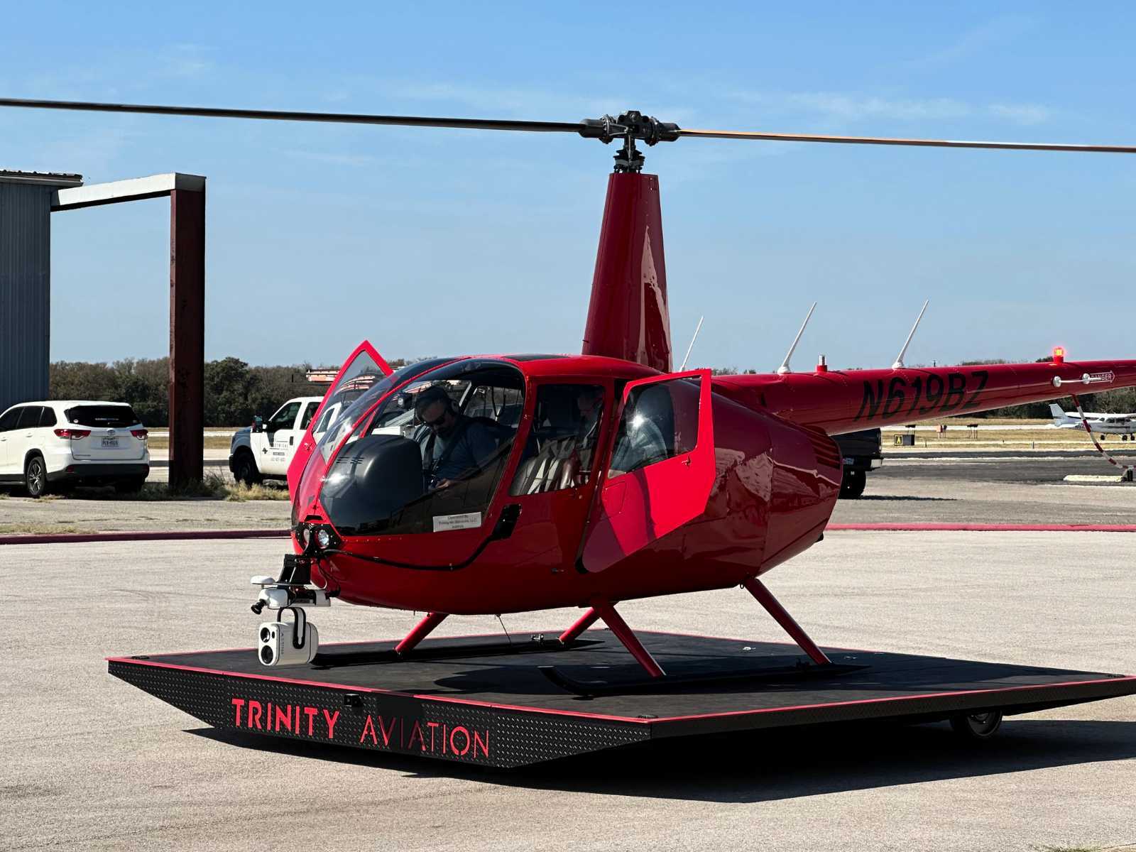
Universal Aircraft Compatibility | FAA-approved STC and authority-approved mounting systems ensure seamless installation on helicopters and airplanes without costly modifications.
The HELIUX Focus delivers enterprise-grade performance at the industry's most competitive price point. Get professional results without the premium cost—making advanced aerial data collection accessible for projects of any scale.
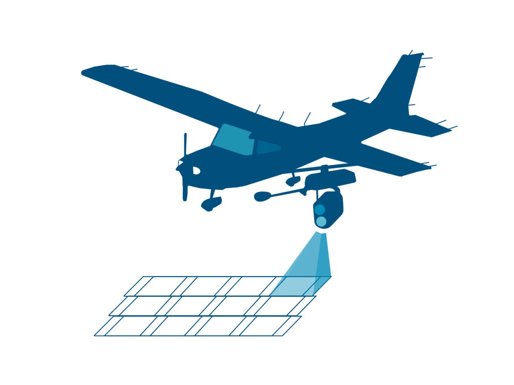
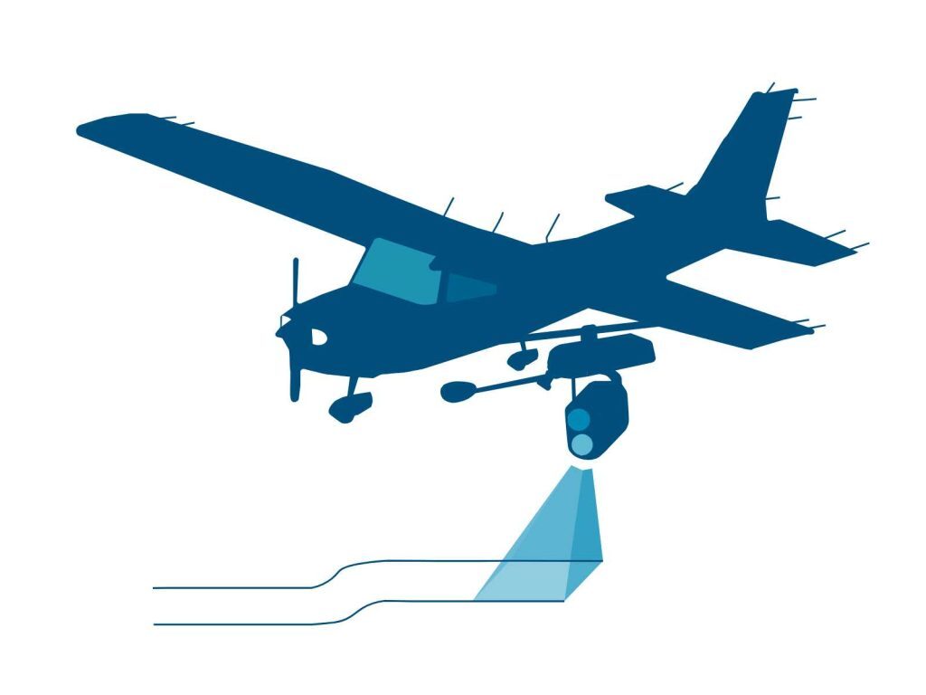
Efficiently survey large areas with systematic back-and-forth coverage. The HELIUX FOCUS captures comprehensive multi-spectral data using thermal, RGB, and NIR cameras simultaneously—perfect for mapping extensive terrains and agricultural fields with precision and speed.
Capture comprehensive multi-angle imagery with circular flight paths that deliver oblique perspectives from every direction. Multi-spectral cameras simultaneously record thermal, RGB, and NIR data for complete situational awareness.
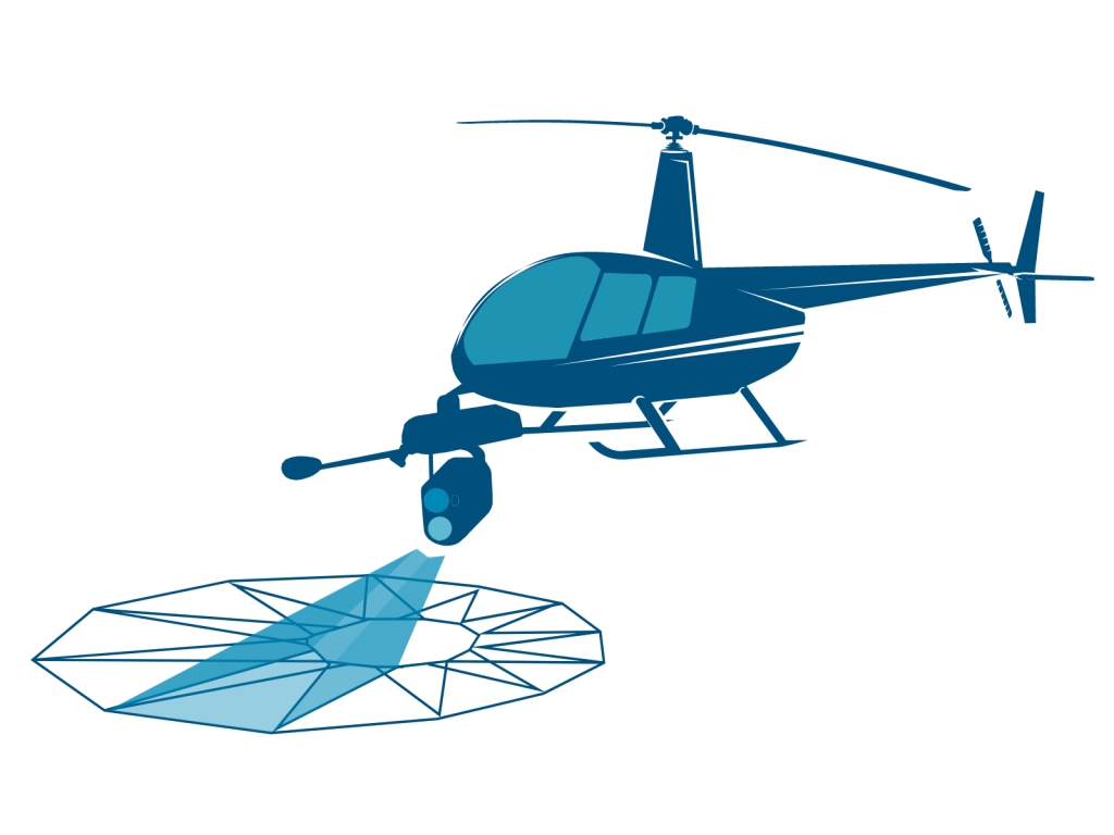
Lock onto any point of interest and maintain continuous, high-resolution tracking throughout your entire flight. Our intelligent follow system captures front oblique, nadir, and back oblique perspectives automatically, ensuring your target stays perfectly centered and in focus.
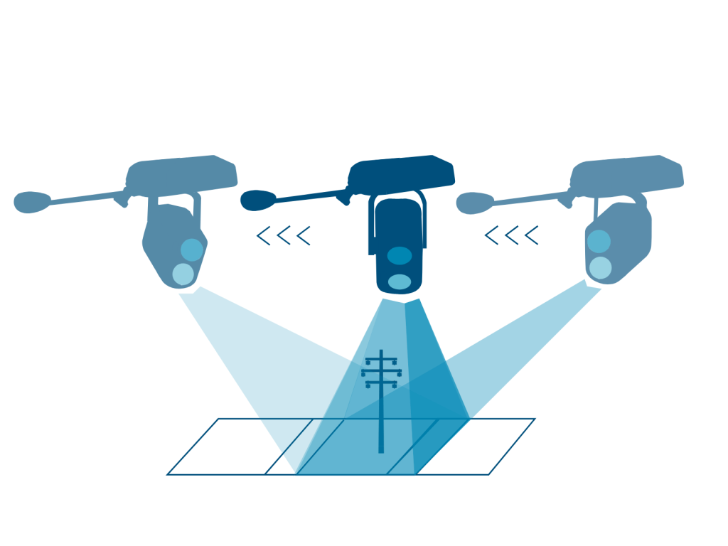
Track linear infrastructure with unwavering accuracy using GPS-guided flight paths. Perfect for pipeline inspection, power line monitoring, and transportation corridor mapping where consistent alignment and continuous coverage are essential.