Freefly Systems / Compact Industrial Drone Platform / NDAA & Blue UAS Cleared
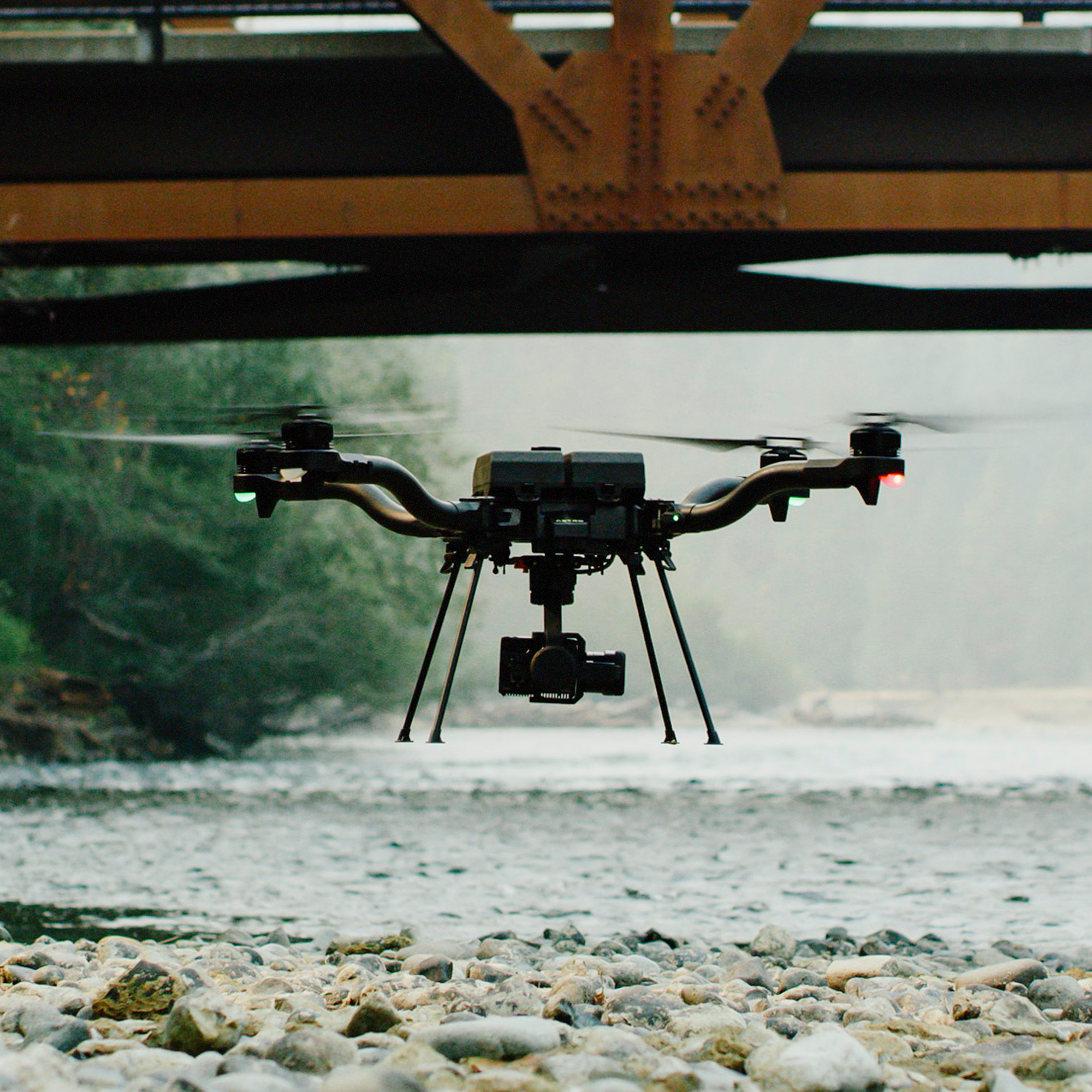
Freefly's flagship compact industrial drone platform. 61 MP Sony LR1 imaging, 28-minute flight time with payload, Skynode mission computer with LTE, Auterion Enterprise PX4, and Smart Dovetail for rapid payload swaps. 100,000+ successful commercial flights. Designed, built, and supported in Woodinville, WA.
Astro was engineered for the operational demands of professional programs: hot-swap batteries, centimeter-accurate positioning, an onboard mission computer with LTE, and a payload interface standard used across the industry.
Astro runs the largest props possible for a drone its size — 21 inch folding carbon fiber on a 14-inch square frame. 96% of total area is props. Freefly spent years developing motor drive hardware and control algorithms to achieve the stability and control bandwidth that large, slow-spinning props require.
Latest 21700 round-cell lithium ion chemistry with an OLED display, CAN communication to the aircraft, and USB-C PD output for accessories. Freefly guarantees 500 cycles minimum. Hot-swap capable — stay powered all day without full shutdown. Fleet battery health tracked in Auterion Suite.
Astro runs a custom Freefly-designed Skynode flight controller with a Cortex-A53 onboard Linux computer and integrated LTE modem. Auterion Mission Control for flight planning and Auterion Suite for fleet management, compliance tracking, and predictive maintenance.
L1/L2 GPS, GLONASS, BeiDou, and Galileo as standard. The F9P locks onto 20+ satellites for rock-solid positioning in wind. Add a Freefly RTK base station and accuracy increases 10x to centimeter level. Velocity clamps on Pilot Pro allow speed adjustment in flight from cruise to 0.1 m/s precision positioning.
Freefly's Smart Dovetail is the industry standard for drone payload interoperability. Pixhawk Payload Bus compatible with power, MAVLink, Ethernet, and serial breakouts. Swap payloads in seconds. 16+ validated payloads from LiDAR to thermal to multispectral. CAD and integration kits available.
Industry-favorite ground control station with 6+ hour runtime, Hall-effect gimbals and rockers, and a dual safety kill switch. Discreet controls for all key drone and gimbal commands. Available with Herelink or Doodle Labs NDAA-compliant radios. Velocity clamp controls available real-time in flight.
Designed and tested to the standard of a platform that carries irreplaceable sensors in high-stakes situations. Freefly publishes the full test plan — structural, environmental, electrical, software, and payload — for every customer to review.
Most drones compromise prop size for control bandwidth. Freefly spent years on motor drive hardware and control algorithms that allow the Astro to run 21-inch props at 40 kHz/s acceleration on a drone body only 14 inches square. The result is a longer flight time, lower noise floor, and finer control precision than any competing platform of this size.
350 W continuous / 600 W peak per motor. Sine-wave ESC eliminates cogging and audible switching noise, enabling the quiet, stable hover that defines the Astro's field reputation.
During testing, Freefly achieved 40,000 RPM/s motor acceleration the upper limit before the folding prop adapter reaches structural limits. This bandwidth is what makes Astro's position hold exceptional in high-wind conditions.
With no payload, the Astro achieves 39 minutes on a single SL8-Air battery. With the LR1 mapping payload fitted, effective mission flight time is 28 minutes covering over 220 acres at 2 cm GSD.
Confirmed flight times from Freefly's published performance data. 2 × SL8-Air batteries at sea level.
No Payload
0 kg / 0 lb
Sony LR1 Payload
0.97 kg / 2.1 lb
LR1 + Thermal
LR1 + 640px radiometric
Inertial Labs RESEPI
1.4 kg / 3.1 lb
Astro's Smart Dovetail interface is the industry standard for payload interoperability. Vertical Aspect supports the primary sensor configurations used in professional survey, inspection, and federal programs.
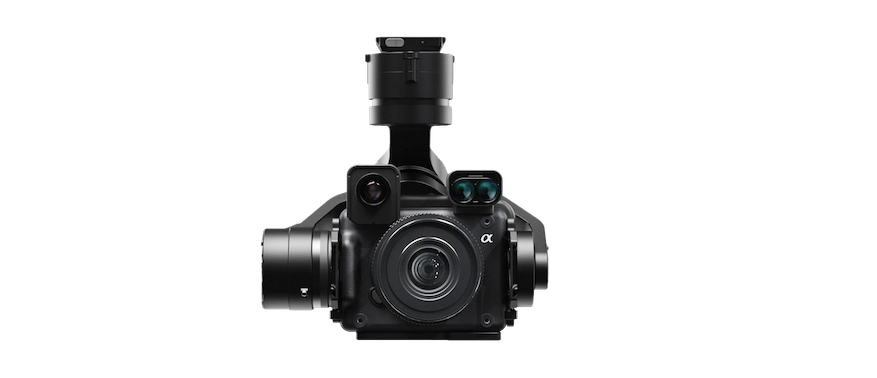
61 MP Sony sensor with vibration-isolated gimbal. Supports 24 / 35 / 50 / 75mm lenses. Optional thermal (640px radiometric, <40 mK) and laser rangefinder add-ons. 28-minute flight at 970g. 220+ acres at 2cm GSD per flight.
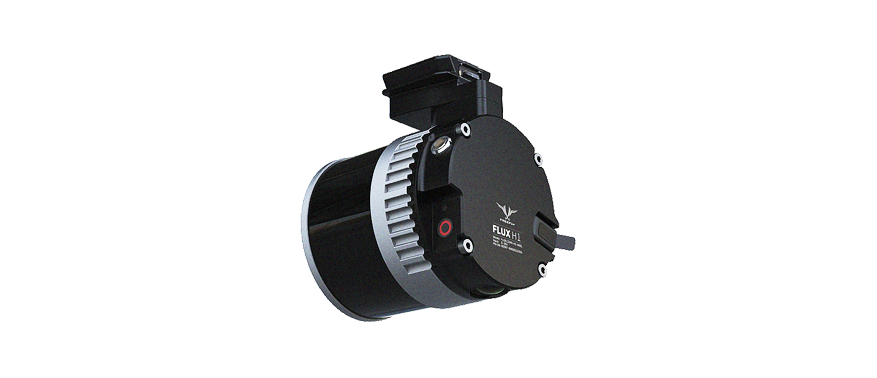
Freefly's own LiDAR payload line: Flux H1 (Hesai XT-32MX, 715g), Flux O1 (Ouster OS1, NDAA compliant, 663g), and Flux L1 (entry-level non-repetitive scan, 715g). Professional results in a travel-ready package.
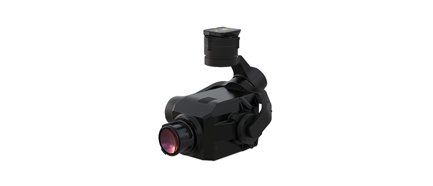
Compact Astro-ready optical gas imaging sensor for precision aerial gas leak detection. Detects hydrocarbon and other gas leaks in pipeline, utility, and industrial infrastructure inspection missions. 1,320g / 2.91 lb.
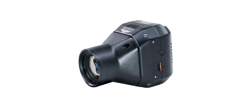
NDAA-compliant 65MP global shutter mapping sensor at 588g. Sentera 6X multispectral at 511g for precision agriculture, with thermal and thermal pro variants. Full suite of Sentera sensors validated on Astro Smart Dovetail.
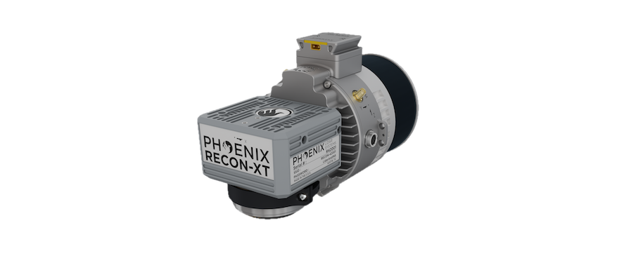
Full-featured LiDAR with integrated RGB camera for survey-grade corridor mapping and 3D modeling. Smart Dovetail mount with 1,800g payload weight. Point cloud and imagery delivered in a single flight. Survey-grade output for infrastructure and terrain.
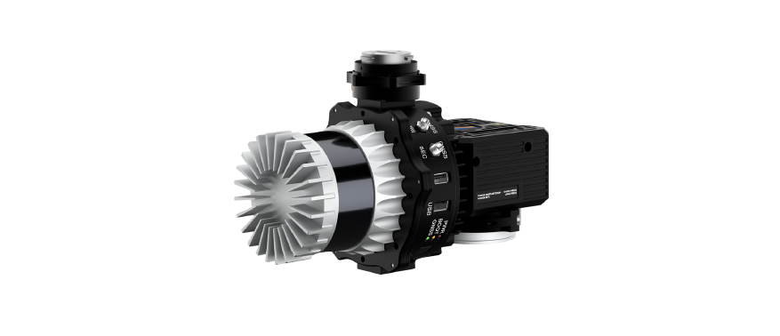
NDAA-compliant LiDAR and RGB camera system on Smart Dovetail at 1,400g. Ouster OS1-64 sensor delivers high point density for corridor mapping, terrain modeling, and infrastructure inspection. One of the few LiDAR payloads where both sensor and platform meet federal procurement requirements end to end.
Compact, backpack-portable, and payload-agnostic. The combination of 28-minute loaded endurance, centimeter-accurate positioning, and 16+ validated payloads makes Astro effective across a wide range of demanding field programs.
61 MP Sony LR1 with RTK delivers 220+ acres at 2cm GSD in a single 28-minute flight. Suitable for cadastral, construction progress, and large-scale terrain survey programs.
LR1 + thermal (640px radiometric, <40 mK) for utility, solar, and infrastructure inspection. Geotagged imagery, custom isotherms, and exposure range controls from Pilot Pro.
Flux H1/O1/L1, Hovermap ST-X, Phoenix Recon XT, YellowScan, ROCK R3 Pro, and more all validated on Smart Dovetail. Swap from photogrammetry to LiDAR in minutes between flights.
NDAA/Blue variant with special DIU firmware and NDAA-compliant hardware. DoD Blue UAS Cleared List. Eligible for federal and state acquisition. LTE fleet monitoring via Auterion Suite.
Sentera 6X multispectral (511g), 6X Thermal Pro, and Micasense Altum-PT all validated on Astro. NDAA-compliant options available for program requirements.
Geospatial solutions for surveying and mapping professionals — hardware, software, and field-tested workflows.
Want more information?
1520 Clay Street
Kansas City, MO 64116
© 2026 Vertical Aspect LLC. All Rights Reserved.