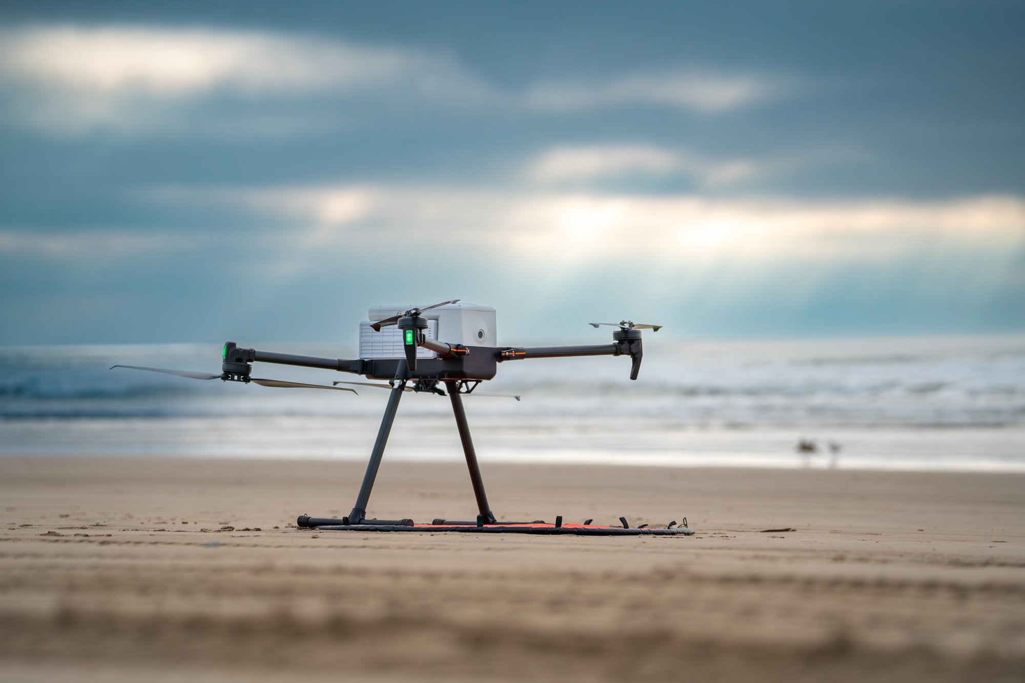
A mission-ready quadcopter engineered for professional field operations. CubePilot Cube Blue flight controller with triple-redundant IMU, Pixhawk Payload Bus interface, dual GNSS, adjustable payload rail with CoG compensation, and a 54-minute unloaded flight time. NDAA compliant, Blue UAS cleared, Green UAS certified. Engineered and assembled in the United States.
Every design decision on the IF800 prioritizes operational reliability: a flight controller with three independent IMUs, payload interface that supports the full professional sensor ecosystem, adjustable center-of-gravity rail for mixed payload configurations, and an airframe that folds to a 40 lb travel case.
The Cube Blue H7 runs ArduPilot Copter with three independent IMUs — each on isolated, vibration-damped mounts. If one IMU is affected by vibration or failure, the flight controller continues operating on the remaining two. The definitive safety architecture for professional sensor-carrying operations.
Two independent CubePilot Here4 GNSS/compass units provide full redundancy in positioning and heading. Multi-constellation GPS, GLONASS, BeiDou, Galileo. RTK/PPK capable with dedicated antenna mounting points on the airframe for clean multi-band antenna installations without cable routing workarounds.
Pixhawk Payload Bus delivers power, MAVLink, and serial to the payload in a standardized interface that matches the growing ecosystem of professional sensors. 12V at 2A payload power rails. Compatible with Sentera 65R, 6X, Sony LR1, and all sensors built to the Pixhawk Payload Bus specification without custom wiring.
The adjustable payload rail allows center-of-gravity compensation for sensors of different shapes and weights — critical for maintaining stable, level flight when swapping between LiDAR, multispectral, and RGB payloads without recalibrating the aircraft. Tool-free mounting with mechanical safety locks confirmed before takeoff.
Integrated LightWare SF000/B laser rangefinder provides accurate ground distance measurement for precise altitude hold in low-altitude operations. Critical for survey missions flown at constant AGL over uneven terrain — maintains consistent image GSD and LiDAR point density regardless of terrain undulation.
Folded dimensions: 14.2 x 17.4 x 7.8 inches. Transport case including aircraft and GCS weighs 40 lb. Diagonal prop span of 905 mm unfolded. Designed for single-person deployment without ground support equipment. Fully flight-ready from case in the field in under 5 minutes.
Built for industry professionals, enterprise users, and first responders who demand excellence, the IF800 TOMCAT delivers uncompromising performance with a 54-minute maximum flight time, hot-swappable intelligent batteries, and 49 MPH speed capabilities.
This Blue UAS and NDAA compliant platform carries up to 6.6 lbs of payload while maintaining IP43 weather protection, making it the trusted alternative to legacy systems for government agencies and security-conscious enterprises.
The precision-engineered system features an integrated FPV camera for enhanced situational awareness, supports comprehensive payload integrations including optical imaging, EO/IR thermal, and LiDAR solutions, and packs efficiently into a ruggedized transport case with foldable frame and removable landing gear for rapid deployment.
The IF800's Pixhawk Payload Bus interface and adjustable rail system integrate with a wide range of industry-leading sensors. Vertical Aspect stocks and supports the primary survey, mapping, and inspection configurations used operationally by our customers.
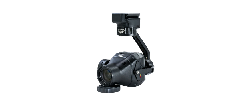
NDAA-compliant 65 MP global shutter sensor with gimbal on Pixhawk Payload Bus at 588g. Global shutter eliminates rolling shutter distortion at survey speeds. Optimized for high-resolution orthophoto and 3D model production.
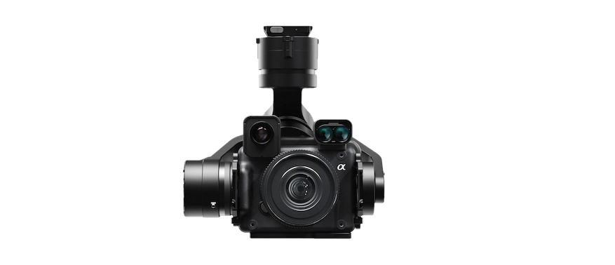
61 MP Sony sensor with vibration-isolated gimbal on Pixhawk Payload Bus. Supports 24 / 35 / 50 / 75mm lenses. Optional thermal (640px radiometric) and laser rangefinder modules. Confirmed IF800 compatible. NDAA/Blue compliant. Used operationally for reef monitoring and aerial survey programs.
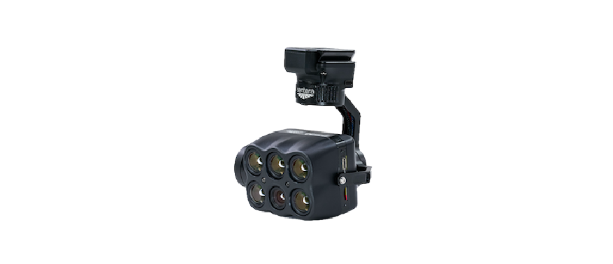
Four 3.2 MP precision-filtered multispectral imagers (Green / Red / Red Edge / NIR) plus 20.1 MP RGB at 5 FPS. Onboard multi-layer image registration. 512GB SSD. NDAA compliant.
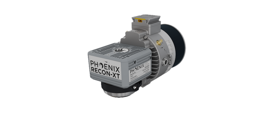
The IF800's payload rail supports LiDAR sensors for 3D mapping and terrain modeling across complex environments. CoG adjustment rail ensures stable flight with heavier LiDAR packages. Dedicated RTK/PPK antenna mounting points ensure clean multi-band GNSS installations for post-processed point cloud accuracy.

Geospatial solutions for surveying and mapping professionals — hardware, software, and field-tested workflows.
Want more information?
1520 Clay Street
Kansas City, MO 64116
© 2026 Vertical Aspect LLC. All Rights Reserved.