![]() TerraModeler transforms your LiDAR data into detailed surface models and terrain maps that drive better project decisions. As an essential component of the Terrasolid software suite, it bridges the gap between raw point clouds and the precise 3D models your projects demand.
TerraModeler transforms your LiDAR data into detailed surface models and terrain maps that drive better project decisions. As an essential component of the Terrasolid software suite, it bridges the gap between raw point clouds and the precise 3D models your projects demand.

Create Surfaces That Tell the Complete Story | Build accurate surface models from any data source with confidence. TerraModeler's advanced algorithms process complex terrain features, ensuring your models capture every critical detail needed for engineering, planning, and analysis.
Seamless Workflow Integration | TerraModeler integrates seamlessly with TerraScan and other Terrasolid applications, creating a unified workflow from point cloud processing to final surface modeling. Your data flows smoothly through each stage without compatibility concerns or data loss.
Scale to Any Project Size | From single-site surveys to large-scale regional mapping, TerraModeler adapts to your needs. The full version includes powerful batch processing capabilities that automate repetitive tasks, letting you handle massive datasets efficiently while maintaining consistent quality.
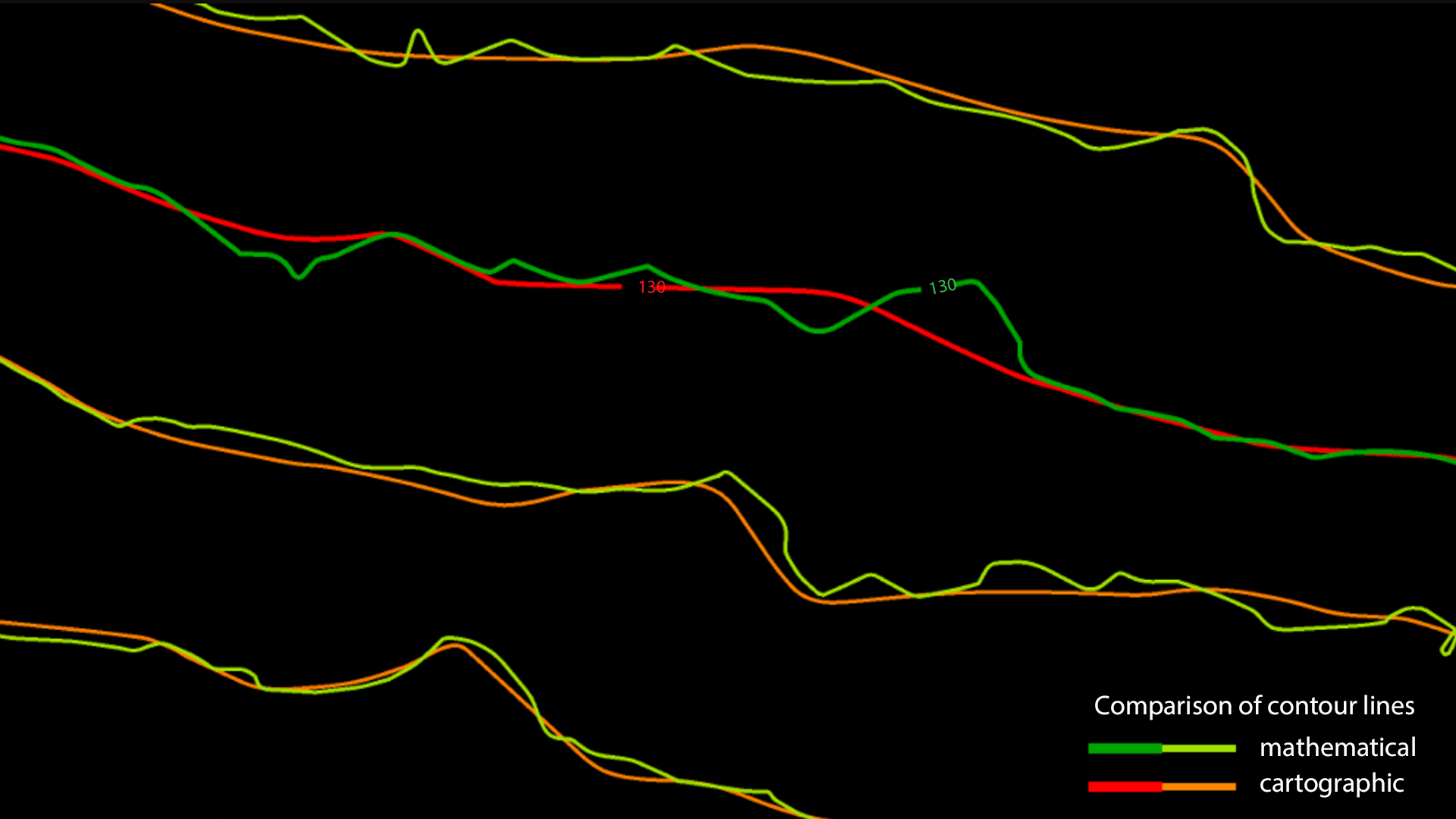
Visualize Your Data, Your Way | See your terrain from every angle with flexible visualization options. Whether you need detailed contour maps, 3D renderings, or analytical views, TerraModeler presents your data in the format that best supports your decision-making process.
![]() TerraModeler is available in Full, UAV and Lite versions
TerraModeler is available in Full, UAV and Lite versions