Virtual Surveyor revolutionizes topographic surveying by seamlessly converting drone data into precise CAD and GIS deliverables. Our advanced software bridges the gap between aerial data collection and professional survey outputs, enabling surveyors to work faster, safer, and more efficiently than ever before.

Virtual Surveyor delivers a comprehensive suite of professional-grade tools designed to streamline your entire surveying workflow from drone capture to final deliverables. At the heart of the software lies an integrated photogrammetry engine, the Terrain Creator app, which processes drone photos into survey-grade digital surface models and orthomosaics without requiring any third-party software. This seamless integration eliminates the complexity of managing multiple applications and ensures consistent, high-quality results throughout your project lifecycle.
This advanced surveying tool provides everything you need for precise topographic mapping and feature extraction. The complete suite includes intuitive point-and-click drawing capabilities, sophisticated planimetric surveys for 2D feature mapping, intelligent breakline detection, and automated feature recognition that significantly reduces manual digitization time.

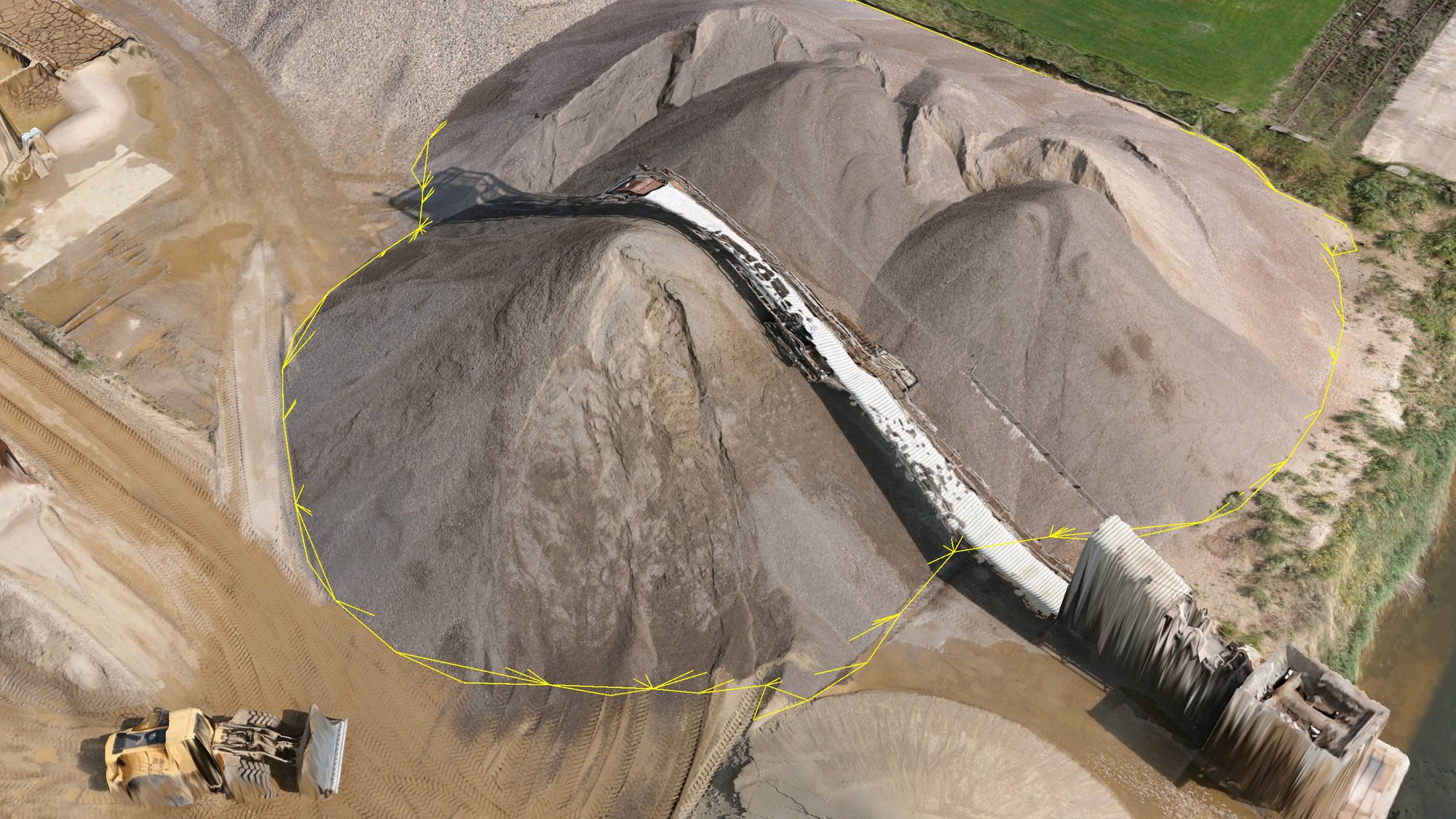
For industries requiring volume calculations and earthwork analysis, Virtual Surveyor excels with its accurate stockpile and volume reporting capabilities. The software provides precise volume calculations essential for mining, quarrying, and construction operations, complete with automatic center of mass determination for earthworks projects. Our cut-and-fill analysis tools enable you to compare existing terrain with design surfaces, calculating exact cut and fill volumes needed for construction planning and ensuring projects stay within budget and timeline constraints.
The software's CAD integration ensures seamless workflow continuity by exporting directly to AutoCAD, Civil 3D, and other industry-standard formats, allowing engineers to immediately begin working with survey data in their preferred design environments.