
UAV Consulting
Vertical Aspect specializes in introducing our clients to the advantages offered by Unmanned Aerial Vehicles and the associated processing software. We can work with you to help determine your specific needs and which solutions or approaches may best fit those needs.

Training
Our mission is to provide our customers with the right tools and knowledge to get the most out of this emerging technology. Vertical Aspect’s flexible training programs provide them with the following skills:
* Drone piloting
* Pix4D applications
* Virtual Surveyor
We offer both in-person and remote training sessions to accommodate our clients’ needs.

UAV Mapping Services
Vertical Aspect can provide custom mapping services – generally with very short turnaround
Plan the mission (determining client parameters such as area to be covered, frequency of mapping, etc.)
Fly the mission – using whichever UAV type (fixed wing or multirotor) is appropriate for the location
UAV Aerial Imagery Services
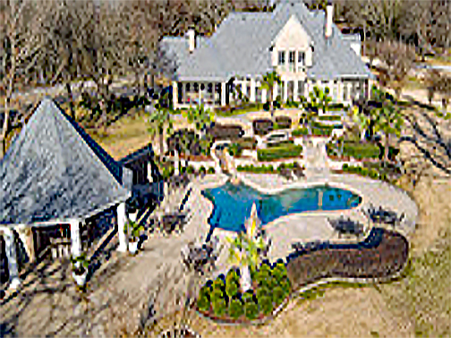
We can provide a variety of aerial imagery services, either in conjunction with a mapping project, or as a separate event. Uses include:
* Aerial Inspections
* Real Estate Marketing
*Determining vision Sight Lines during construction planning
General aerial perspective with a variety of applications