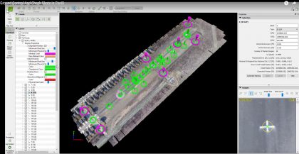
Ground Control Points (GCP) & Check Shots in Pix4D

This video explains the difference between Ground Control Points (GCP) and check shots and how to use both of them within Pix4D Pro Mapper software to obtain survey grade accuracy Attributes of GCPs and Check Points GCPs are used to rotate, scale and orientate the project in a real world location or in some cases in a “Local Coordinate System) GCPs are typically statically placed around the outside edge of the project with at least one GCP in the interior of the project GCPs should not be more than 1,000-1,500 …
Read More

0
Drone Mapping Accuracy – Part II – Real Time Kinematics (RTK)

In an earlier post, we discussed Ground Control Points as a primary method of obtaining survey grade accuracy from drone mapping. The photogrammetry/mapping software (such as Pix4d Pro Mapper) uses these GCP to make adjustments to the project to obtain survey grade accuracy. However, this method requires laying out and precisely geolocating numerous control points (approximately every 1000 to 1500 feet). Depending on the terrain and/or the size of the project, the GCP method could be very impractical, difficult and time consuming. Another, arguably more advanced method, is referred to …
Read More

0
Components for Drone Mapping

In this article we cover what’s actually needed – both in terms of hardware and software products, as well as the training and other items necessary to generate UAV mapping products. 1. Drone (UAV) – Fixed Wing or Multirotor Multirotors are a great initial platform – they’re less expensive, easier to fly and the smaller datasets (due to the smaller area covered) are faster to process. A DJI Phantom 3 Advanced or Pro makes a great low-cost starter platform, while a Phantom 4 Pro is not significantly more expensive and …
Read More

0
Drone Mapping Accuracy – Part I – Ground Control Points (GCP)

In the business of UAV mapping, accuracy is everything. As my surveyor partner indicates, “If you don’t have an accurate project, it’s nothing more than a pretty picture…”. Close enough is great if you are playing horseshoes or tossing hand grenades. However, if you are doing UAV mapping, being “close enough” is a waste of your time and your clients’ money. So, how do you obtain the highest amount of accuracy in your drone mapping project? The most common method is to use Ground Control Points. (Another method, Real Time …
Read More

0
Uses for Drone Mapping

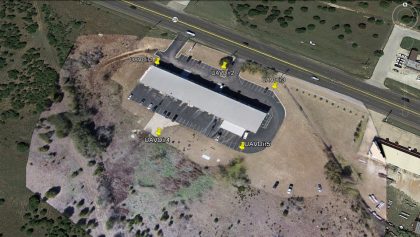
One of the first questions we receive from those new to drone mapping, is “What use is drone mapping to me? – What can I do with drone mapping?” In this article, we’re going to show, at a high level (pun intended) that the UAV mapping field has significantly more capabilities than the typical “Google Earth” type of map… Orthomosaics That being said, an orthomosaic is what is represented in Google Earth. It’s a combination of a multitude (up to thousands) of individual, overlapping nadir (pointed straight down) photos. …
Read More

0
What’s the best way to learn UAV Mapping?

There are two main methods . The way we learned I’ll refer to as the (Guess, Buy, Fly, Crash, Fix… repeat) process. There are numerous online videos, drone forums, software knowledge bases for those that want to self-teach. Most professionals and businesses find it much more efficient to hire a consultant to help determine your requirements, make recommendations on hardware and software and provide the training…
Read More

0
What does it take to generate UAV aerial mapping products?

The general components needed for mapping are:
Drone (UAV) – fixed wing or multirotor
Mapping Flight Planning software (controls drone in capturing numerous images with proper overlap)
Most multirotors use either as an iOS or Android app (e.g. Pix4D capture app, Map Pilot for DJI (our favorite) or Drone Deploy)
Fixed wings tend to use a Windows program through a laptop or tablet…
Read More

0
1 2 3 4 14