Drone Mapping Accuracy – Part I – Ground Control Points (GCP)

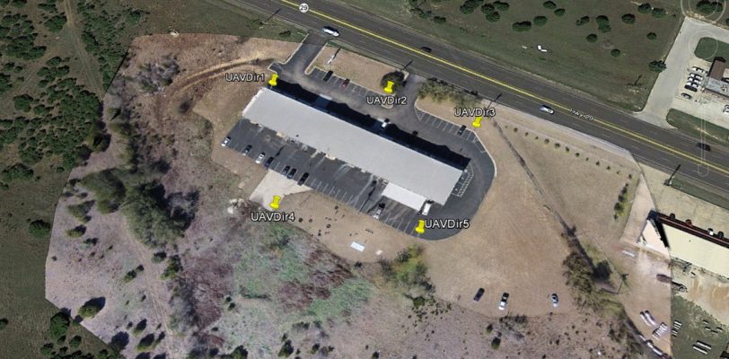
In the business of UAV mapping, accuracy is everything. As my surveyor partner indicates, “If you don’t have an accurate project, it’s nothing more than a pretty picture…”. Close enough is great if you are playing horseshoes or tossing hand grenades. However, if you are doing UAV mapping, being “close enough” is a waste of your time and your clients’ money. So, how do you obtain the highest amount of accuracy in your drone mapping project? The most common method is to use Ground Control Points. (Another method, Real Time …
Read More

Uses for Drone Mapping

One of the first questions we receive from those new to drone mapping, is “What use is drone mapping to me? – What can I do with drone mapping?” In this article, we’re going to show, at a high level (pun intended) that the UAV mapping field has significantly more capabilities than the typical “Google Earth” type of map… Orthomosaics That being said, an orthomosaic is what is represented in Google Earth. It’s a combination of a multitude (up to thousands) of individual, overlapping nadir (pointed straight down) photos. …
Read More

What’s the best way to learn UAV Mapping?

There are two main methods . The way we learned I’ll refer to as the (Guess, Buy, Fly, Crash, Fix… repeat) process. There are numerous online videos, drone forums, software knowledge bases for those that want to self-teach. Most professionals and businesses find it much more efficient to hire a consultant to help determine your requirements, make recommendations on hardware and software and provide the training…
Read More

What does it take to generate UAV aerial mapping products?

The general components needed for mapping are:
Drone (UAV) – fixed wing or multirotor
Mapping Flight Planning software (controls drone in capturing numerous images with proper overlap)
Most multirotors use either as an iOS or Android app (e.g. Pix4D capture app, Map Pilot for DJI (our favorite) or Drone Deploy)
Fixed wings tend to use a Windows program through a laptop or tablet…
Read More

How Hard is it to fly a Drone?

The “monkey skills” (as I’ll refer to them for learning how to fly the drone) are not very complicated. While you wouldn’t want to just pull our brand new drone out of the box, charge the battery and launch it without learning something about it, around 3-4 hours of learning the basics of the aircraft and its associated software can get you to safely making takeoffs, landings and flying around…
Read More

Vertical Aspect speaking at “New Opportunities with Drones” workshop

Vertical Aspect will be speaking both days of the American Association of Petroleum Geologists (AAPG) workshop in Houston, TX on 1-2 Dec. We’ll be presenting on “Mapping with Drones on a Budget” on Dec 1st and “Launching Drone Services” on the 2nd. See the AAPG magazine article about the Mapping on a Budget presentation… We’ll be posting both presentations in our Resources section the week following the workshop…
Read More

1 2 3 4 13