Home
About Us
Vertical Aspect Team
Vertical Aspect Offerings
Products
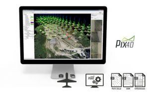
Pix4D Pro Mapper
Robota Eclipse
Virtual Surveyor
Services
Aerial Imagery Services
Training
UAV Consulting
UAV Mapping Services
Gallery
Video Gallery
Our Blog
Resources
UAV Mapping Apps & Links
Frequently Asked Questions
Presentations
Training Videos
Financing & Credit
Sitemap
Contact Us
Video Category
Aerial Mapping
Inspections
News-Interviews
Pix4D Outputs
Ranches & Real Estate
UAV Products
Pix4D Product Info
Robota Eclipse
Virtual Surveyor for Pix4D
UAV Training
Back to Video Gallery
Back to Main Gallery
16 videos found
Using Pix4D files to create terrains in Virtual Surveyor
ELpnarf6wF
/
64 views
Virtual Surveyor for Pix4D
,
UAV Products
,
Pix4D Product Info
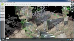
Pix4D – Mapping and Inspecting a power tower
ELpnarf6wF
/
146 views
UAV Products
,
Pix4D Product Info
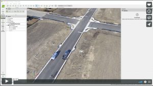
Pix4D-Which Output Files Should Be Used?
ELpnarf6wF
/
33 views
UAV Products
,
Pix4D Product Info
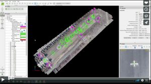
Ground Control Points (GCP) & Check Points-Pix4D Pro Mapper
ELpnarf6wF
/
81 views
UAV Products
,
Pix4D Product Info
Pix4D – Construction Solutions
ELpnarf6wF
/
28 views
UAV Products
,
Pix4D Product Info
Pix4D – Real Estate Solutions
ELpnarf6wF
/
30 views
UAV Products
,
Pix4D Product Info
Pix4D – Surveying Solutions
ELpnarf6wF
/
26 views
UAV Products
,
Pix4D Product Info
,
Aerial Mapping
Pix4D – Agriculture Solutions
Mark Paulson
/
26 views
UAV Products
,
Pix4D Product Info
Pix4D Chillon Project 3D Model
Mark Paulson
/
23 views
UAV Products
,
Pix4D Product Info
,
Pix4D Outputs
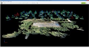
Pix4D Simply Powerful
Mark Paulson
/
5 views
UAV Products
,
Pix4D Product Info
rayCloud Tutorial
Mark Paulson
/
19 views
UAV Products
,
Pix4D Product Info
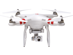
DJI Phantom 3 & Inspire 1 Takeoffs-Landings
Mark Paulson
/
9 views
UAV Products
Pix4D Mapping
Mark Paulson
/
7 views
UAV Products
,
Pix4D Product Info
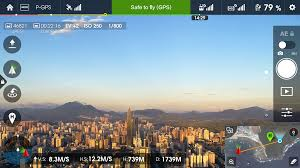
Pix4D Mapping-DJI App
Mark Paulson
/
16 views
UAV Products
,
Pix4D Product Info
Pix4Dmapper DJI App for Android OS - Guided Tour
senseFly eBee Flight
Mark Paulson
/
9 views
UAV Products
rayCloud Introduction
Mark Paulson
/
15 views
UAV Products
,
Pix4D Product Info
Sub Categories
Virtual Surveyor for Pix4D
1 video
Pix4D Product Info
14 videos
Username or Email Address
Password
Remember Me
Search for:
Search for:
Home
About Us
Vertical Aspect Team
Vertical Aspect Offerings
Products
Pix4D Pro Mapper
Robota Eclipse
Virtual Surveyor
Services
Aerial Imagery Services
Training
UAV Consulting
UAV Mapping Services
Gallery
Video Gallery
Our Blog
Resources
UAV Mapping Apps & Links
Frequently Asked Questions
Presentations
Training Videos
Financing & Credit
Sitemap
Contact Us